Rivers in the UK: The Hidden System Shaping Britain (2026 Guide)
That sensitivity explains a hard truth most people don’t realise: in England, no single river stretch is currently rated in good overall ecological health. This is not an environmental talking point — it directly affects drinking water costs, flood risk, food prices, and public health.
An Overview of Rivers in the UK (2026 Snapshot)
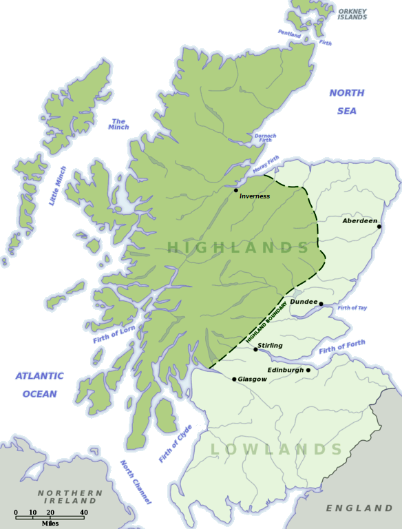
UK rivers fall into four national systems — England, Scotland, Wales, and Northern Ireland — each regulated differently and responding differently to climate pressure.
Scotland holds the highest water quality overall, largely due to lower population density. England contains the densest river network — and the greatest strain. Wales sits in between, while Northern Ireland’s rivers face increasing nutrient pollution from agriculture.
The National River Flow Archive confirms that less than 15% of UK rivers now flow in a near‑natural state. The rest are regulated, diverted, dammed, or abstracted to support households, farming, energy, and industry.
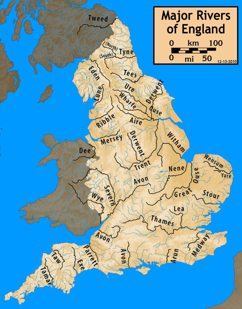
The Longest Rivers in the UK (Measured, Not Myth)
Ask most people and they’ll confidently name the Thames as Britain’s longest river.
It isn’t.
The River Severn remains the longest river in the UK at 220 miles (354 km), rising in the Cambrian Mountains of Wales and flowing into the Bristol Channel. It also has the UK’s fastest tidal bore and highest average discharge.
The River Thames follows closely at 215 miles (346 km). It supplies drinking water to over 15 million people, passes beneath more than 200 bridges, and supports commercial navigation, tourism, and flood defence infrastructure.
Other major rivers by length include the Trent (185 miles), Wye (155 miles), Tay (117 miles), and Clyde (109 miles). Length matters — but volume, flow speed, and seasonal reliability matter more in 2026.
The Real Crisis Facing UK Rivers
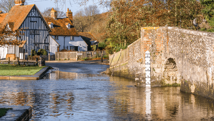
Pollution incidents classified as “serious” by the Environment Agency increased sharply through 2024 and 2025. Sewage discharges, agricultural runoff, microplastics, and so‑called “forever chemicals” now appear in river systems previously considered clean.
In 2025 alone, more than 460,000 sewage overflow discharges were recorded in England, releasing untreated waste into rivers during storm events. These discharges are legal under current permits — and that legal reality shocks many readers when they learn it.
Climate Change and River Flow: What’s Actually Changing
The UK isn’t simply getting wetter or drier. It’s getting more extreme.
Winter rainfall in northern and western Britain is increasing, raising flood risk along rivers like the Severn, Clyde, and Eden. Summer flows in southern and eastern England are falling, concentrating pollutants and stressing ecosystems.
During spring 2025 — the hottest on record — river temperatures rose by up to 1.8°C above recent averages. That sounds minor. Ecologically, it isn’t. Warmer water holds less oxygen, increasing fish deaths and accelerating chemical toxicity.
Human Activity: The Force That Changed Every River
Dams, abstraction points, flood defences, canals, and straightened channels mean that fewer than one in six UK rivers now behave naturally.
Agriculture contributes up to 60% of nitrate pollution in some English catchments. Urban growth adds impermeable surfaces that accelerate runoff. Water extraction lowers summer flows — sometimes to the point where rivers temporarily run dry.
A List of Major Rivers in the UK (2026 Reference)
1. River Severn – 220 miles – Wales & England – Bristol Channel
2. River Thames – 215 miles – England – North Sea
3. River Trent – 185 miles – England – Humber Estuary
4. River Wye – 155 miles – Wales & England – Severn Estuary
5. River Tay – 117 miles – Scotland – North Sea
6. River Clyde – 109 miles – Scotland – Firth of Clyde
7. River Tweed – 97 miles – Scotland/England – North Sea
8. River Avon (Bristol) – 94 miles – England – Severn Estuary
9. River Eden – 81 miles – England – Irish Sea
10. River Tyne – 74 miles – England – North Sea
Why This All Loops Back to You
The rivers of the UK are not failing quietly in the countryside. They surface in higher water bills, stricter hosepipe bans, flooded homes, fishery closures, and drinking water treatment costs.
Once you see Britain as a network of rivers rather than a patchwork of towns, everything changes. Housing policy, farming subsidies, climate adaptation, and infrastructure planning all trace back to the same blue lines on the map.
The UK’s rivers have always shaped the country. In 2026, they are shaping its choices.